Complexion Springs
I wake up with a headache. California’s Central Valley is a beautiful and fascinating place for much of the year, but during the fall harvest the air becomes clogged with dust and smoke, so much so the great bathtub walls of the Sierra Nevada to the east and the Coastal Range to the west vanish in an atmospheric haze. It’s not uncommon in the small town where I live to hear a chorus of sneezing during the transitional seasons when pollen counts climb and smoke and dust worsen.
In the Sacramento Valley–the northern third of the Central Valley, beginning in the wetlands outside Sacramento and ending below the volcanic peak of Mount Shasta–great plumes of smoke often mark the horizon that, starting out dense and complexly dimensional only to flatten completely when they hit the inversion layer, where a westerly wind spreads it out in an even haze across the whole valley.
This is only one small piece of everyday life living in an agricultural community, but it’s one of the most impactful. It changes the color of the sky and darkens the air. It conceals the mountains that wrap either side of the valley so as to appear endlessly flat. Respiratory problems proliferate among the young and old alike. And allergy sufferers like myself wake morning after morning with plugged sinus cavities and dull outspreading headaches that trace a fractal pattern in the cartilage that underlies our faces.

The Berryessa Snow Mountain National Monument stands some forty miles to my west, generally at an altitude of 1500-3000 feet. To get to it from Colusa County, where I live, is to negotiate a series of folds in the earth, amazingly well-defined wrinkles in the terrain forming tightly packed hills of golden brown grasses and the sun-dulled foliage of oak trees that resolve into a series of bucolic and isolated valleys. These valleys, still occupied in many instances by the homestead families who settled them in the 19th century, are situated between steep slopes and offer astonishing long distance views over the lumpen backs of cows and horses.
In my mind these valleys form a buffer between the rugged lands to the west and the flatter, more agriculturally useful lands of the Central Valley. The passes that offer ingress and egress through the steepest of these hills frequently traverse road cuts that display in discreet layers the deep sedimentary history of the Great Valley Sequence, the complex of soils that underlies the Central Valley and that here can be seen in a stage of uplift as it collides with ancient rock originating from the floor of the Pacific ocean.
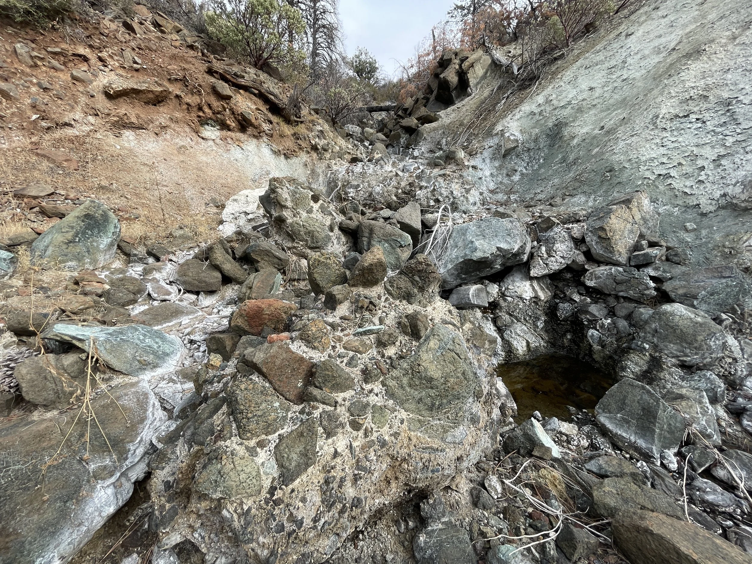
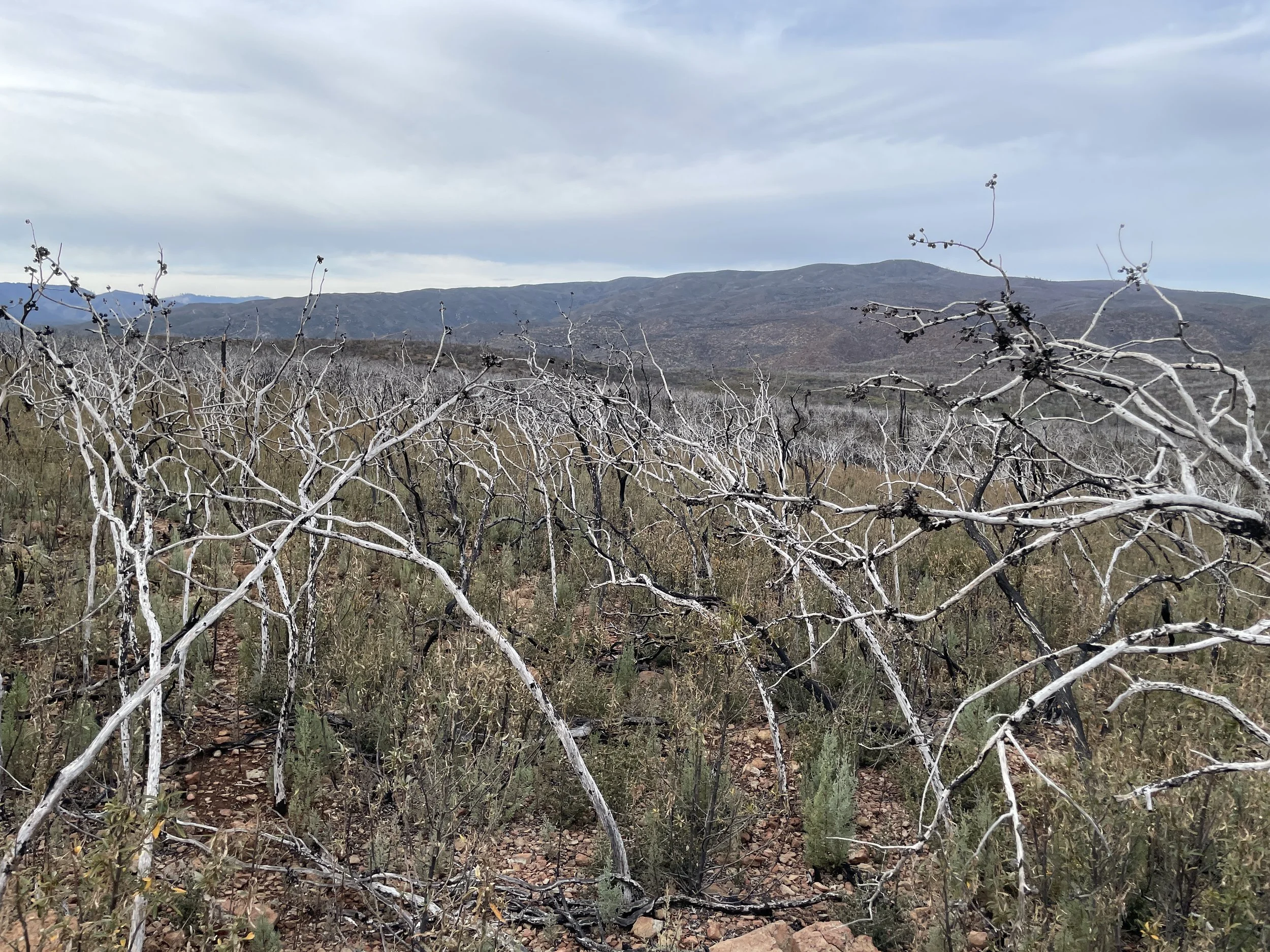
The Great Valley Sequence presents itself in these road cuts as a series of perfectly straight layers, sometimes nearly vertical, sometimes diagonal, sometimes nearly horizontal, sometimes shattered and unrecognizable. Evidence of the marine rock belonging to the Franciscan Complex can be seen in these hills in blue-green outcrops of slickened, oily serpentinite, or in the bluish serpentine gravels and their masticated textures. This soil is so effective at retaining water that misplaced feet or hands leave a form-fitting impression in the moist pseudo-mud. Colloquially, serpentine gravel is known as blue goo for its accommodating structure.
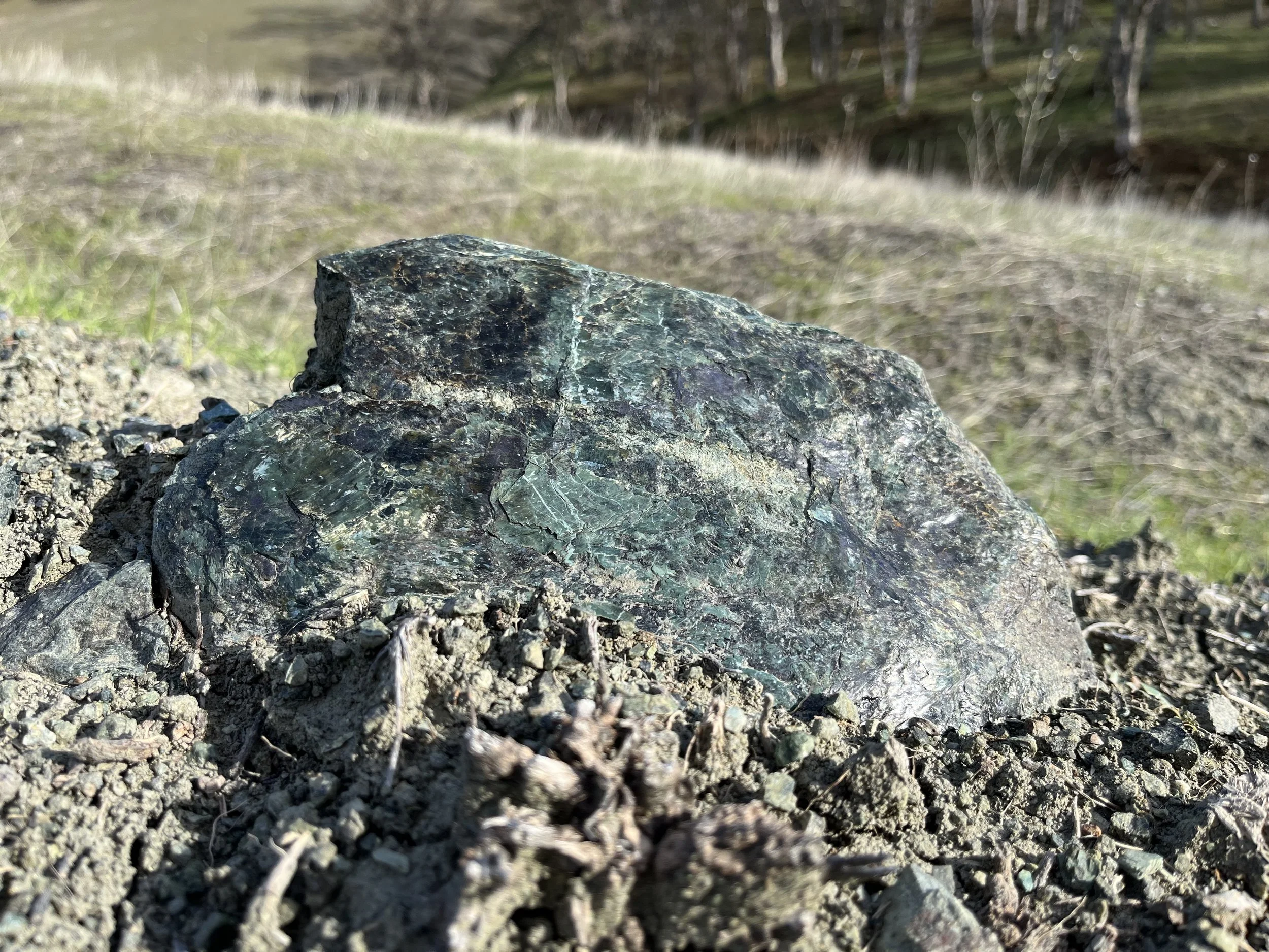
Serpentinite rock on the Berryessa Snow Mountain National Monument.
The final wrinkle to be dealt with before making a day in the Berryessa Snow Mountain National Monument is the most rugged, the most precarious. These are the hills that wash out during the damp winter, that slough entire roads off into the creeks and drainages below. Depending on origin, numerous roads go up into these hills–Highway 128 out of Winters, Highway 20 out of Williams, Highway 162 out of Willows and through Elk Creek, and more at points north–but on this particular day I’d chosen to take Bartlett Springs Road, a single lane dirt road that connects with the northern part of the long and beautiful Bear Valley–my favorite of the eastlying valleys–and cuts its way west through the wildlands north of Indian Valley Reservoir. I have the usual sinus headache, as I said, and I’m a little cautious as one is on these roads: the last time I’d attempted Bartlett Springs Road, a wide, deep, brown puddle forced me to turn around.
But this time the road is dry, I rumble through the low indent that will fill with mud come wintertime, which is threatening its start any day now. This road climbs up from Bear Valley through a rugged, almost desertlike terrain dotted with the skeletal remains of burned manzanita, the copper-brown of late season chemise, and the dull green tangle of chaparral plant communities typical to the foothills of California’s mountain ranges. Much of this land burned in the 2018 Ranch Fire, ignited by a rancher hammering a metal stake into the ground and eventually burning close to half a million acres forest and grassland.
Entangled in this thick understory is herba sante, leather oak, new manzanita saplings, toyon, silver bush lupine, sagebrush, the list goes on: these plants grow side by side almost everywhere I look, and as long as they’re not poison oak I love to admire them.
The rolling grasses that hold small hamlets in the lesser hills here erode away to reveal dark basaltic spires, a brittle burned-looking rock that forms miniature buttes. It strikes me how different this route into the monument looks from other routes that are only five or ten miles due north or south. To the north, where the monument rises to its highest point, the terrain and ecosystems are more classically montane: old growth conifers, tangled green underbrush, rising all the way to the wind-scoured alpine zone at the summit of Snow Mountain. To the south, in the Cache Creek watershed, the land is characterized by gentle oak woodland, with mature valley oaks towering in places over meadows in glades. But here, it’s sparse, almost desertlike–a product of the nutrient-poor serpentine rock in the soil below. Geological maps provide a birds-eye-view of the rock underlying the monument. In long curves and undulations and in spurs and islands geologists trace the origin and composition of the soil.
But up here, on the surface, the soil dictates the plant life, and crossing from grassy woodlands to scrubby chaparral is one indicator of what’s happening in the earth’s interior. Learning to read the land on Berryessa Snow Mountain National Monument is also learning to read the mineral content belowground, and how it affects life above.
But I don’t stop at these rock formations on this trip. The road drops into a tight canyon with gray pine and McNab cypress growing precariously in the loose slopes. From an embankment, I see an unusual site for this area: flowing water, late season. While springs abound in the monument, flows of surface water are largely seasonal, and outside springtime and the major watersheds, it’s common to see the broken blue lines on a map that indicate water sources, only to find a dry, waterless drainage channel.
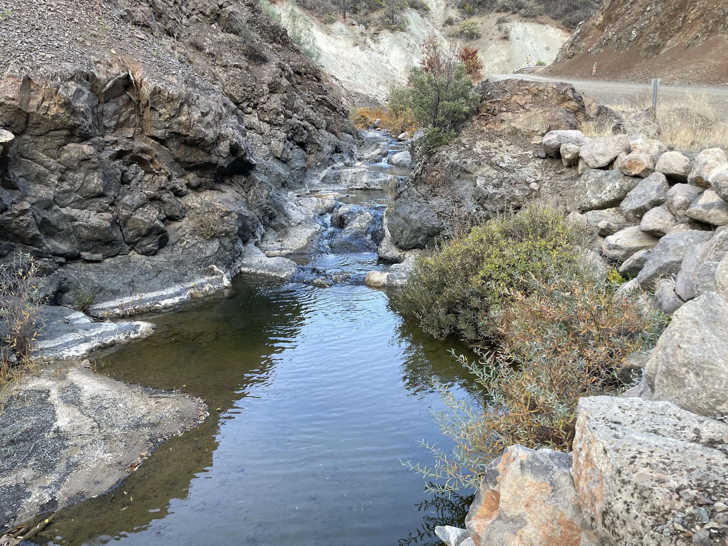
The road fords the creek, and I splash through it without problem. I see a pull-out in the shoulder and a break in the shrubs, where people or animals have made a path down to the creek. I park, change into my hiking shoes, and throw my backpack on. I probe around in the brush next to the road with my trekking poles. No poison oak–good sign!
The path drops down to a crossing, and I use a couple of tall rocks to keep my feet dry as I cross. On the other side, a trail rises up a berm and out of sight. I follow it for a mile or so, climbing five hundred feet. Below, the creek grows wider and the current stronger. Where highwater follows have receded, a white mineral residue stains the creekbed and exposed rocks.
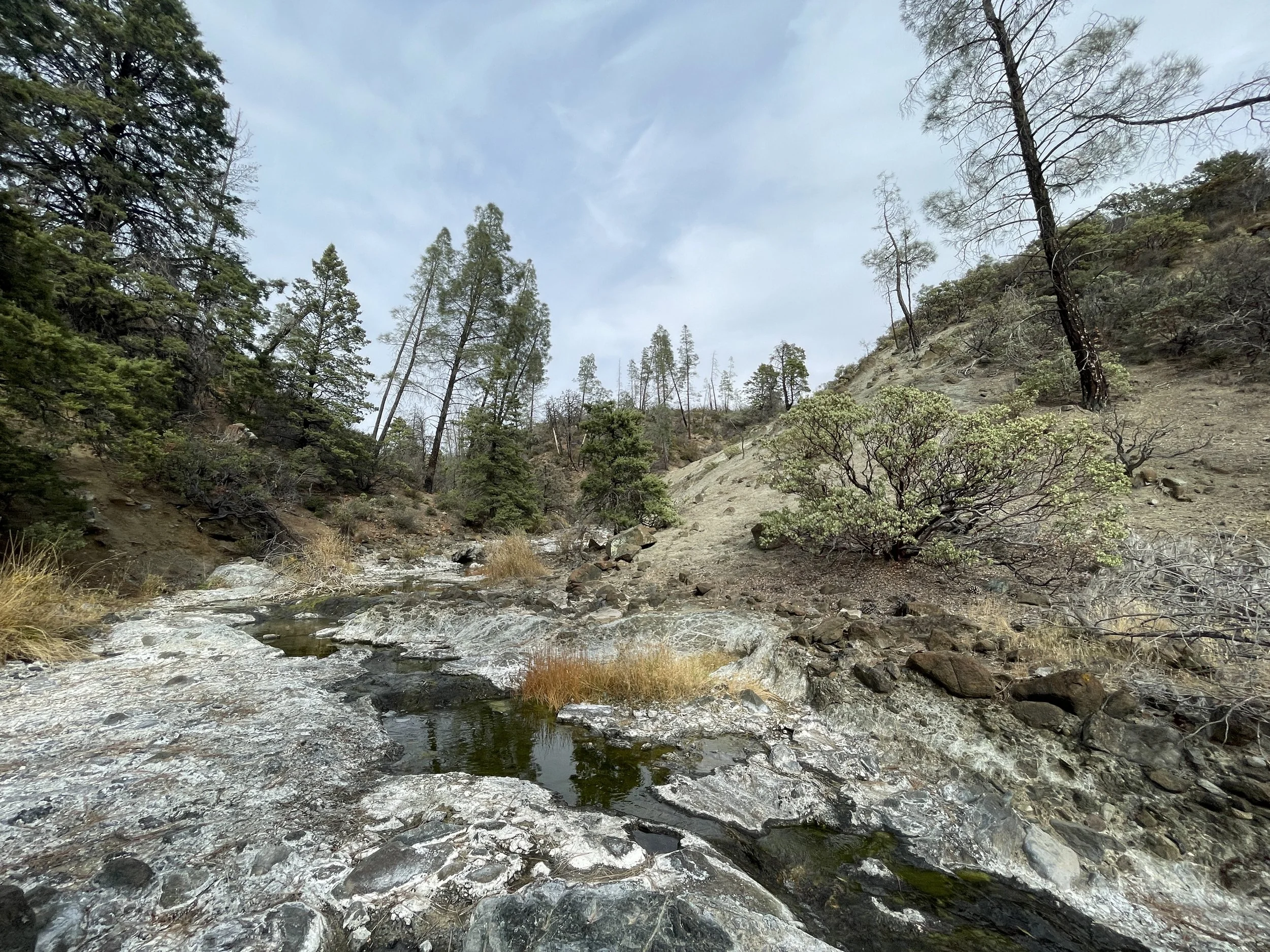
The trail ascends to a wide, flat peak. Indian Valley Reservoir is visible to the south, and to the north a fire scar abuts unburned land drainages that climb up to a high ridge, the southern boundary of the Mendocino National Forest. In many cases, it’s obvious where firelines held during wildfires. Burned patches with shin-height saplings collide with manzanita and cypress fifteen feet high.
It’s obvious the trail I’m walking is a firebreak left over from a past wildfire. The burn history in this area is extensive. Nearly the whole portion of the monument north of Highway 20 burned in the Ranch Fire. But I’m not the only one who’s decided to take this trail. The trail stretches another hundred yards across the summit of this hill, and every few feet I find mountain lion scat either loose or half-buried on the ground. Mountain lion scat will be obvious to anyone who has a cat at home, and especially obvious because it tends to be rich with bones–the sign of a predator. I glance nervously into the cypress stands and manzanita grove that surround me. I talk to myself, trying to make myself heard and known in case any pumas are hanging around.