6. Redbud Trail
The Redbud Trail, departing from Highway 20 and granting access to the Cache Creek Wilderness and Bear Creek trail system along Highway 16, is named for the many Western redbuds that bloom bright pink in the riparian ecosystems of the Cache Creek watershed. One finds redbuds all along the highway on the drive in, and from the trailhead, they’re easily identifiable in the spring by their vibrant blossoms.
The redbud is somewhat anomalous among other native trees and shrubs. The pink of the blooms in my mind resonates more with the springtime blossoms of decorative non-native trees, eschewing the subtle colors of California natives. It’s an explosion of pink, and when the redbuds are peaking, the hillsides become technicolor with their rich tones.
Redbuds are visible right from the start of this trail, which quickly ascends the Cache Creek ridge and drops down to Baton Flat, a spacious camping area with a trailed creek crossing. The trail glows with them in the springtime, peaking around early to mid-April. In late fall, before the rain starts, the Redbud Trail offers a lovely, easy circuit with moderate elevation games, but the colors will be sedate, the grasses and flowers long gone to seed.
Instead of hiking straight up the ridge, I follow an OHV trail along the creek for a quarter of a mile and pick up a trail that will follow a shallow drainage up to the ridge.
This trail is technically on private property, and for that reason the official trail managed by the Bureau of Land Management works overtime to avoid it. But it gets enough use to remain at least faintly visible for its whole course, connecting to the official trail at Baton Flat.
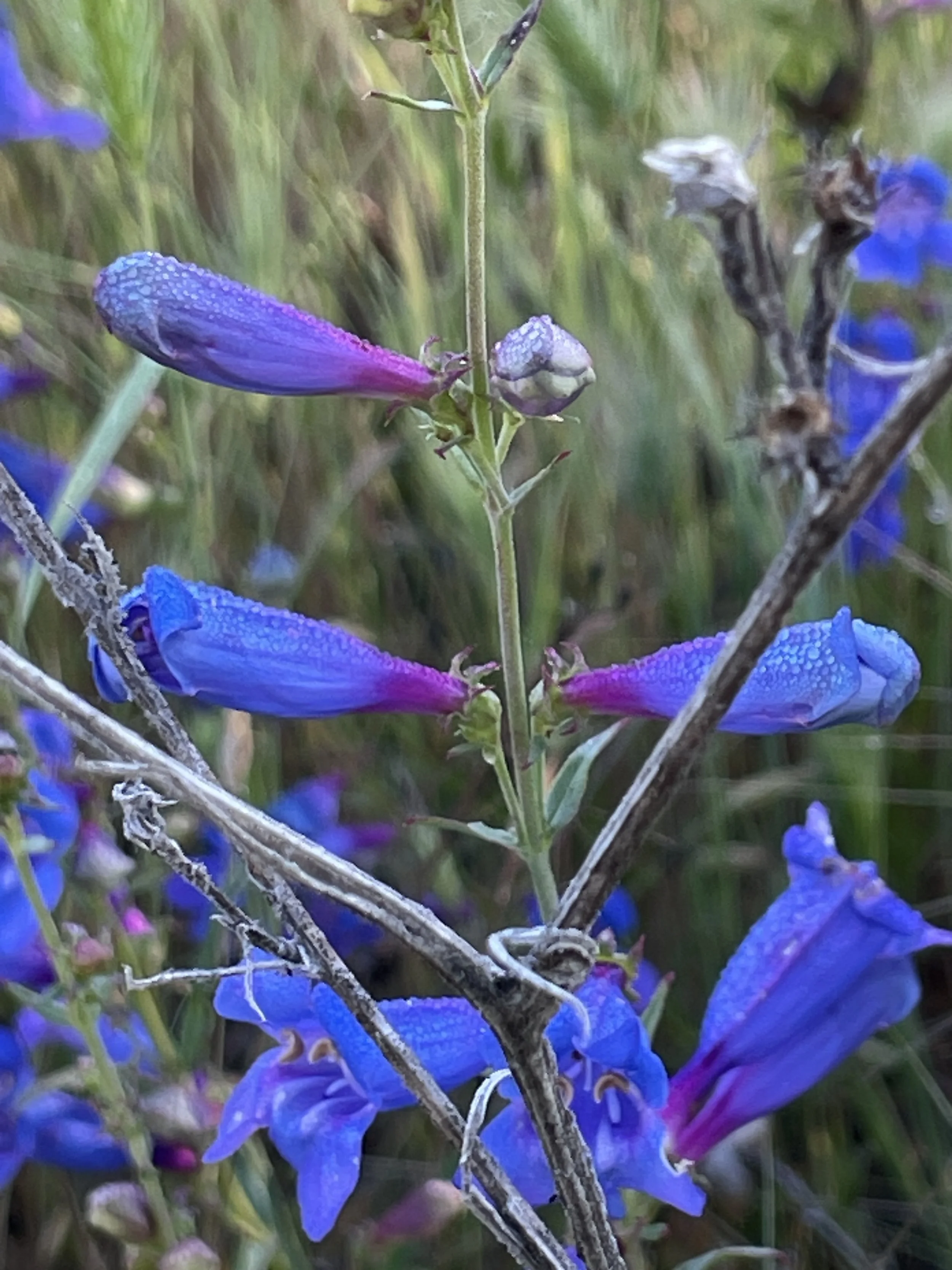
Foothill penstemon, a California endemic, can be found in May along this trail, after the poppies and lupine have mostly phased out. This variety of penstemon is a spectacular flower. In the morning, the petals catch capture the dew, imparting a luminescent quality to the flower as it shades from a deep violet to a cool blue.
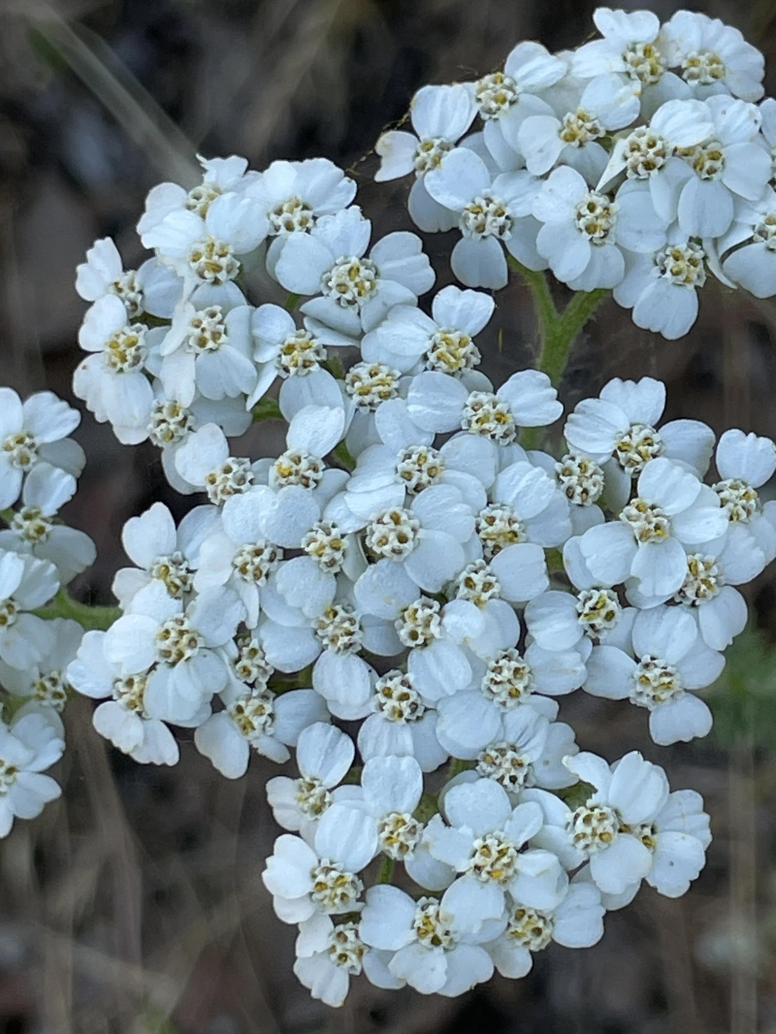
Yarrow, a more subtle wildflower that stands upright with denise white blossoms, blooms along the same slopes as the penstemon. At waist height, its stem is decorated with fine, fernlike leaves, with a bushy white top. Yarrow serves as a great pollinator plant, and research has also shown that birds who use yarrow to line their nests enjoy some protection from parasites, as the plant itself is mildly toxic. People should never eat the plant.
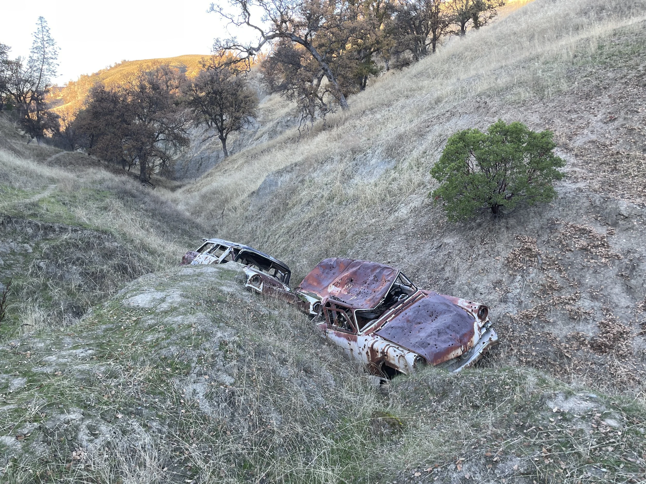
The multilayered character of the monument area makes itself immediately clear on this route. As I climb up the drainage along the unofficial trail, two cars peek out of the soil below the trail. The upholstery is not in tact per se, but it’s visible, and it looks more or less like it did when it was operational. Since much of the area is former ranch land, or former mining claims, or for military use, these remnants of the past are found throughout the trail system. At some point, this trail was a road.
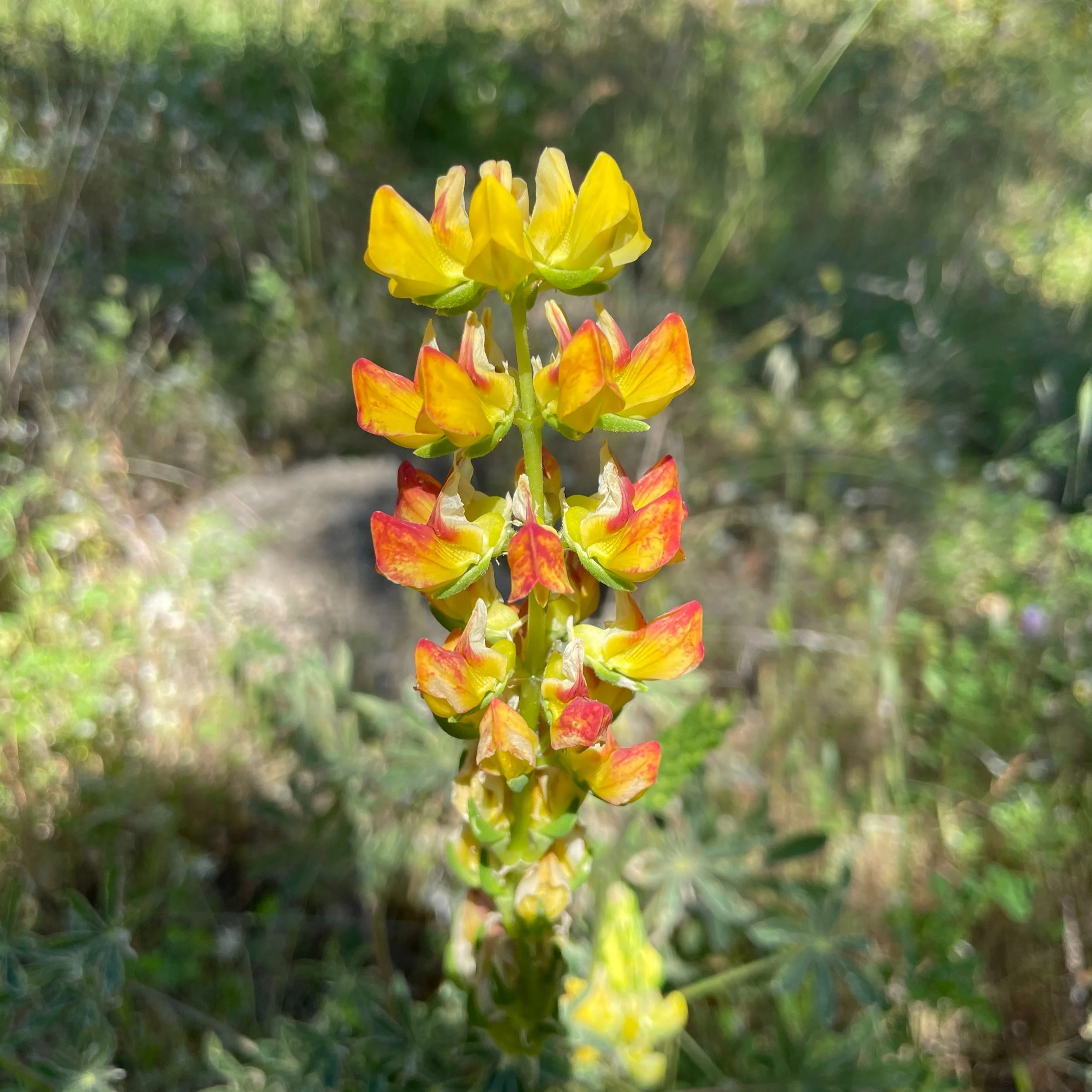
Silver lupine grows alongside the trail here, though it’s past its prime in May. The white-petaled variety is tinged with red as it fades and prepares to reseed for next season.
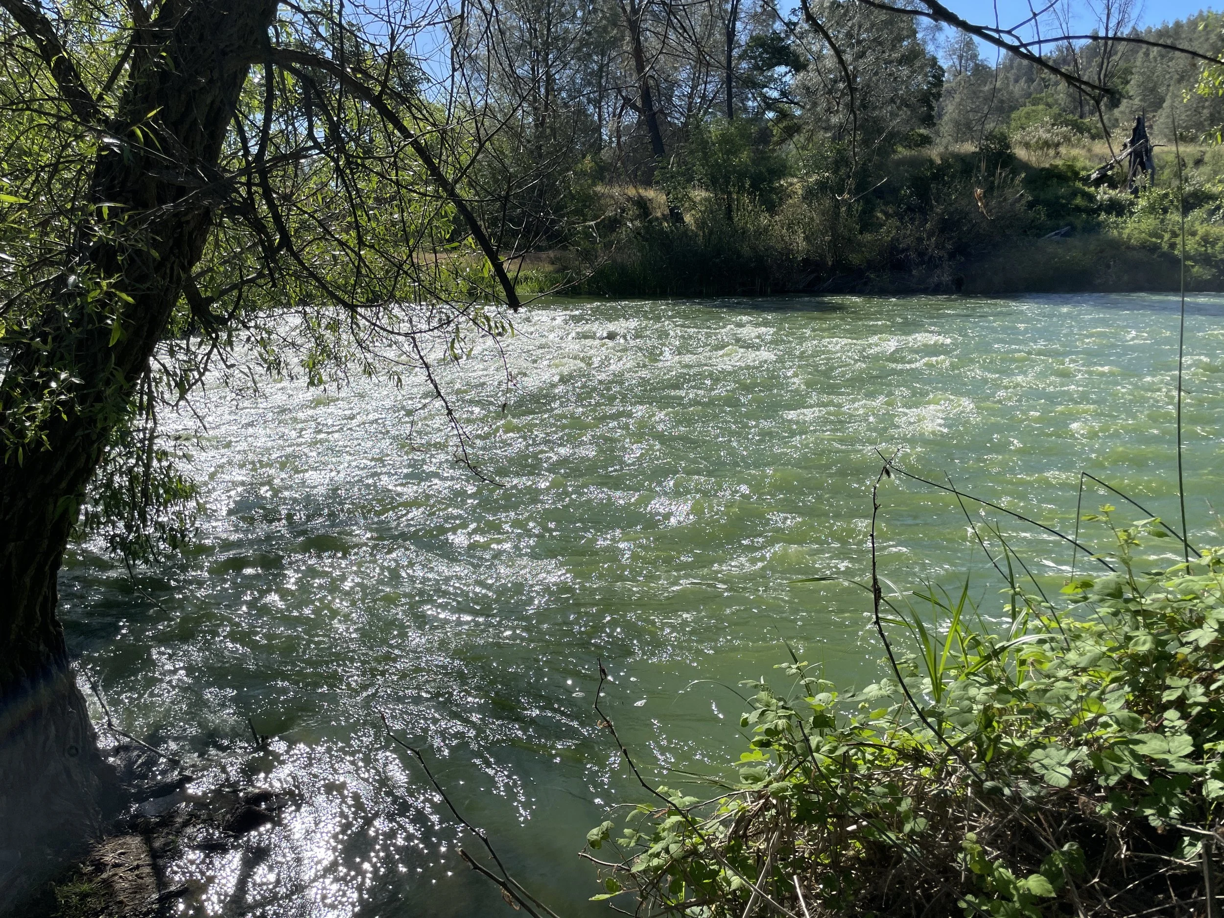
A short but steep climb brings me to the top of the ridge, offering a lovely view of a sage-green Cache Creek. The water in mid-May is stubbornly high, far too high to attempt crossing. When I saw the creek from this same spot in December, its flow was a mild burble.
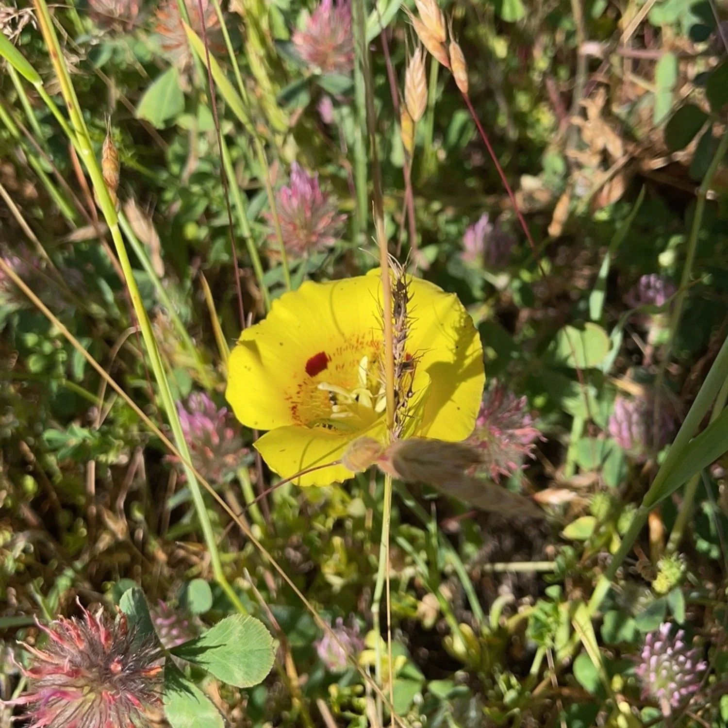
The trail drops straight down to Baton Flat. In the warmer months, star thistle and other invasive grasses may cover this section of trail. I’m surprised to find Yellow Mariposa Lily up here, a beautiful flower I’ve seen in the Sierra Nevada but never in the Coastal Range. They feature beautiful layered petals similar to a poppy, but shaded a buttery yellow with speckles of brown in the interior folds. They grow further apart from one another than the more fraternal poppy, which tends to grow in bunches and clumps.
From here, hikers wishing to push on or stay overnight can cross the creek and rise up above the creek’s southern banks. Poppies and lupine can be found on the serpentine slopes about a mile past the crossing, but hikers should be wary of a blow-out above the creek, where the trail literally falls off a loose cliff. An informal trail circumnavigates it, but requires a keen eye to find and keep track of it, especially on the return trip.
On this hike, I take a breather near the water and eat a protein bar. Where the trail crossing usually starts is covered in deep, swift water. A group camp is set up in a private spot down the creek, where there’s a pleasant, slow-moving swimming area, though swimmers should exercise caution as swift currents can be concealed lower down. Remember that cold, fast water is the most dangerous feature of backcountry travel!
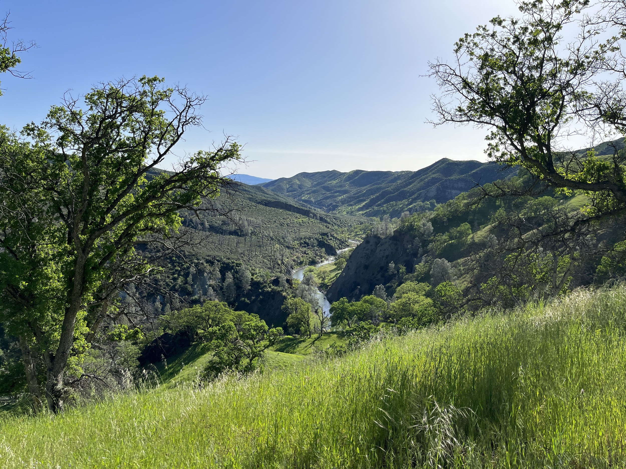
I linger for a few more moments, and pick up the official trail for my return trip back to the trailhead. It switchbacks up the slope, making for a good moderate exertion until it steepens below the ridge. Western wallflower grows in tall orange bursts along the trail here. Excellent views can be found at this point in the ridge, revealing the serpentine shape of the creek as it winds back and forth through a deep canyon.
As hikers cross the ridge, the ecosystem becomes more chaparral heavy. In early May, herba sante’s white flowers are out, but manzanita’s berries have already faded. The showstopper on this hike, though, is ceanothus. This shrub is an excellent replacement for decorative, non-native shrubs in the native garden. At its peak, the bright green stems terminate in light pink flowers, like the mellower sibling of the redbud.
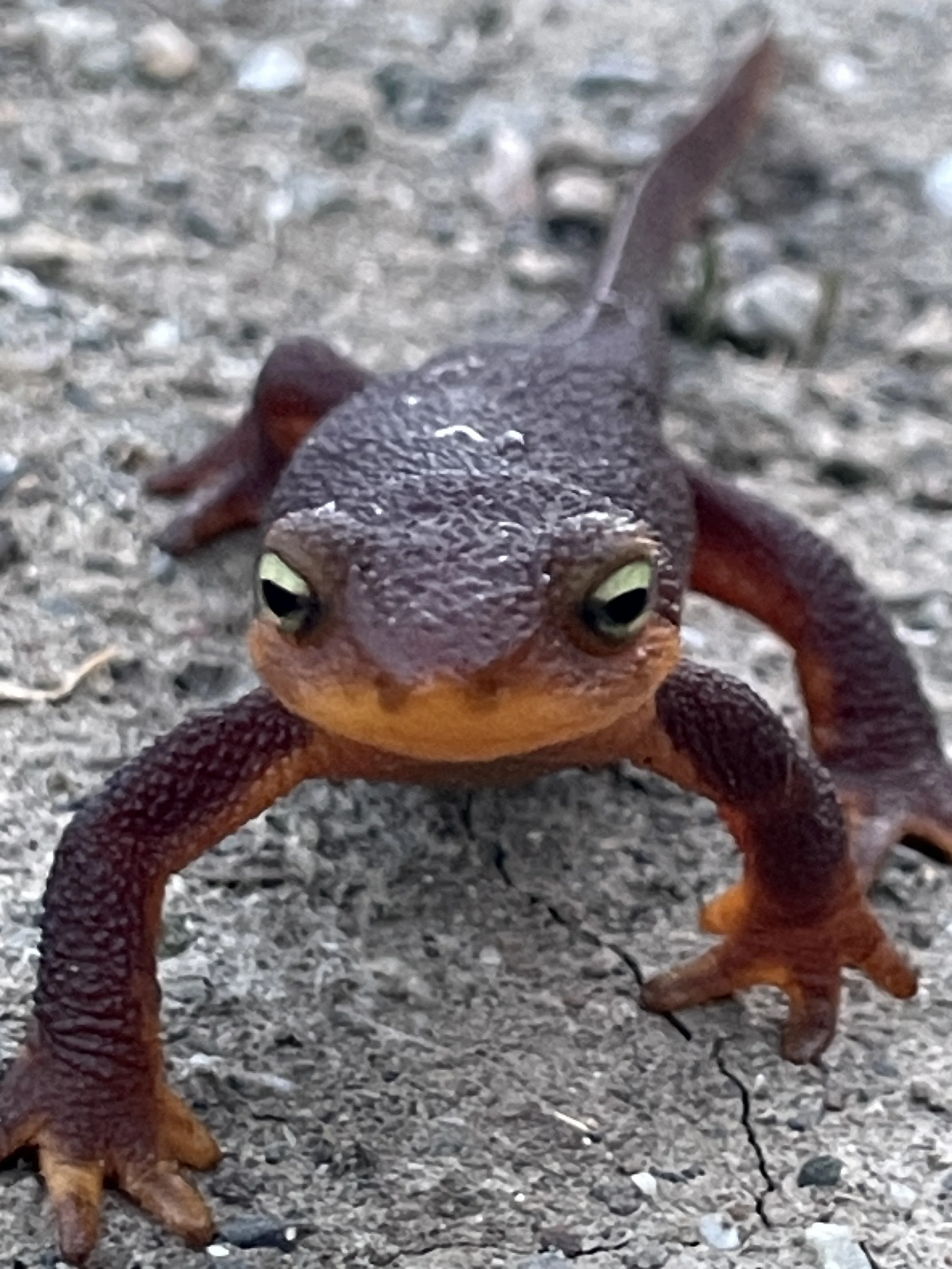
In fall, this section of the trail is a great place to find California newts on their slow annual journey back to their wet winter homes. The newt is a deep, terracotta or burnt orange, and they can be found by the dozen, poking their slow way up these hills.
Newts found in the fall are in their terrestrial form as they initiate its mating season and by returning to the pools where they were born. California newts look shockingly defenseless on trail, their proto-legs slowly conveying its body up the hillside. The toxins in their skin protect them from predators, granting easy passage to the newt on its slow uphill journey. I stop to look at one more closely, peering into its widely spaced eyes. The newts have amazing faces, with huge eyes that stick halfway out of their heads and a dimpled skeletal structure that produces a constant pseudo-smile.
The Redbud Trail is one of the busiest recreation areas on the Berryessa Snow Mountain National Monument. In the parking area, hiking groups and picnickers have begun to assemble. This parking area also offers access to the North Fork of Cache Creek, a popular floating and swimming area during the warmer months.